Introduction
Physical maps are an essential tool for understanding the world around us. Unlike political or road maps, physical maps focus on showing the natural and geographical features of the earth, including mountains, rivers, forests, and deserts. In this article, we’ll explore what physical maps show and why they are an important aspect of global knowledge.
Discovering the World, One Physical Map at a Time: Understanding What Physical Maps Show
Physical maps are defined as visual representations that show the natural and man-made features of a particular area. These maps help us gain a better understanding of the earth’s topography, including the landforms, climatic zones, and vegetation. The purpose of a physical map is to provide a tactile and easy-to-use tool that can guide you through unfamiliar terrain and that offers a visually compelling representation of the natural world.
Compared to other types of maps, such as political maps or road maps, physical maps tend to provide much more information about the earth’s natural features. Rather than focusing on territorial boundaries, physical maps give detailed information about the landscape, including the relief, rivers, lakes, and other features.
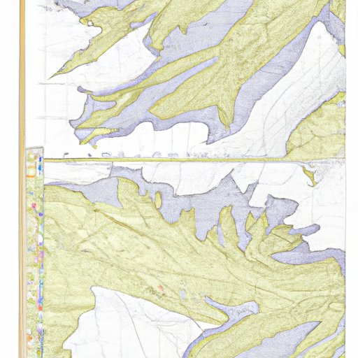
A Beginner’s Guide to Interpreting Physical Maps: Unpacking the Features and Information Displayed
Physical maps contain a variety of information represented using different symbols, colors, and styles. Understanding these features is crucial to getting the most out of a physical map. The key features of physical maps include colors, which represent different land cover types, and symbols representing different natural features like mountain peaks and lakes.
Interpreting physical maps involves understanding how to read and understand different types of information, such as elevation, land use patterns, and climate patterns. In general, physical maps use colors to indicate different elevations and relief features. At the same time, they use contour lines to indicate the slope & elevations changes across the map area.
The Power of Visual Representation: Physical Maps as a Tool for Spatial Analysis and Exploration
When it comes to spatial analysis and exploration, physical maps are an excellent and powerful tool compared to digital maps or satellite imagery. Physical maps can be used to tell complex stories and patterns of land use and other activities over time. In addition, physical maps allow people to design and develop new ideal urban cities that are environmentally friendly and sustainable, area expansions, nature reserves, and other interventions more precisely.
Examples abound of how physical maps have helped scientists and explorers better understand our world’s geography over the years. From uncovering new landscapes to tracking population growth to investigating climate change, physical maps offer a wealth of information waiting to be discovered.
From Mountains to Rivers to Deserts: The Topography Depicted on Physical Maps
When it comes to topography, physical maps provide an accurate and detailed representation of geophysical features. They show the relief, which is the representation of the earth’s surface and its elevation (peak high & lowest level) changes at different positions on the same area’s map. Physical maps display contours (lines linking points of the same elevation) addition to land use patterns and river networks throughout the area covered.
Understanding the topographical representation is essential for many reasons, including urban planning, agriculture, and hazardous activities such as hiking and mountaineering. Physical maps are crucial tools for planners, educators, scientists, and industry professionals alike, helping to make critical decisions related to sustainable development & environmentally-friendly actions in different areas around the globe.
Beyond Borders: How Physical Maps Provide a Holistic Understanding of Geographical Features and Landscapes
Physical maps provide more than just an understanding of a specific area. They help us to see the relationship between natural and human-made features in relation to each other, revealing connections between different parts of the world and uncovering patterns in geographical phenomena.
Furthermore, physical maps can help us understand how people interact with the physical world. They can show the implications of human activities such as urbanization, industrialization, and mining have on the environment and how sustainable measures can improve the local residents’ standard of living.
Physical Maps 101: The Key Elements You Need to Know About to Understand the World Around You
Physical maps are fascinating and have immense value in investigation and analysis of the world. Understanding the different elements and key information presented on physical maps is essential to develop a deeper understanding of the world around us.
The color denominations, the symbols, the usage of contour lines, and different markers on a physical map represent essential elements that need to be taken with earnestness. The importance of reading and understanding physical maps can enhance our geographical knowledge, which can result in deeper insights, appreciation, and awareness of the world’s beauty.
Conclusion
In conclusion, physical maps are powerful tools that help people gain a comprehensive understanding of our planet’s natural and man-made features. By reading and interpreting these maps, we can understand how geography influences various aspects of our daily lives, including environmental sustainability, city planning, and sustainable development.
Physical maps provide an excellent foundation for spatial analysis and exploration, enabling us to discover new landscapes, learn about different parts of the world, and uncover interconnected patterns along the way.